Search
49 results found with an empty search
- Recommended pleasure Multi-Pitch Climbing routes in the Swiss Central Alps (Grimsel & Susten)
I had wanted to go climbing at least once since I moved to France. It has been 7 years since I moved to France that I was finally able to go multi-pitch climbing in the Swiss Alps. My impression on my first climb (July 2018) was that the climbing itself was not very interesting. I had an image of climbing in Switzerland as being deep in the mountains, with spectacular views, and without worrying about the route next to you. But that was alpine climbing (alpinism), and I was thinking "maybe sport climbing with bolts in the first place is not such an elegant way to climb 🤔" This impression turned out to be wrong on Sagittarius (13pitch, max 6b, 450m), which I climbed the following year (2019.8). Sagittarius was a great route with scale, great views, and fun 😂 I learned that there are great routes in Switzerland🇨🇭, even bolted routes, if you choose the right route 🤣 The sport climbing route is a 300/400m ascent, but the altitude at the starting point is high. So if the weather is good, you will definitely have a great view. This may be the best part of climbing in Switzerland. Gelmerfluh Sagittarius (L13, TD 6b>6a, 400m) 🐢 L1 - L9 *We finished in 9 pitch due to lack of time. All pitches are lead climbed. It is a popular route and 7 parties including us (2 parties) were climbing it. It is a route with beautiful slabs and nice cracks. Here are my impressions after climbing up to 9 pitch. The slabs on pitche 8 & 9 are very high altitude and my heart felt numb 🤣 I would climb this route again if I had a chance. Handegg Fair Hands Line (L10, TD- 6a>5c, Trad, 300m) 👱🏻♂️ L1-L5, 🐢 L6-L10 It is (6a/6a+) in terms of grade, but I recommend this route for its variety of slabs, hanging walls, and cracks. The technically difficult parts may be (L2 & L9) 🙄 The last pitch is different in the topo "Schweiz Plaisir west Guidebook for the Eastern Swiss Alps" and in the topo "Dreams of Switzerland". This time I chose the route on the right side described in the "Dreams of Switzerland" topo, but it was a solid slab with no bolts. It is supposed to be (5a/5b) but my heart felt numb 😂 Bergseeschijen Voie Andrea (L10, D 5a>5a, 330m) 👱🏻♂️ L1-L5, 🐢 L6-L10 I lead climbed the last 5 pitches (L6-L10), but the worst part was that there were almost no bolts. I climbed knife ridge climbing with a strong effort, aiming at the occasional bolt. On the other hand, it is an easy grade, and the altitude is quite enjoyable. I think cams (Spring Loaded Camming) are a must. Unless you are used to alpine climbing, it might be tough for a (5c) climber to lead climb this route 🙄 Mittagflue (Guttannen) Südkante (L10, D- 5a>5a, 350m) In the topo (Dreams of Switzerland) it was (5b), but in the web site it was (5a). My personal opinion 🤔 I can't really say as I don't really know the difference between (5a) and (5b) 😅 This route is a slab of granite. The route we climbed was close to the corner, so the view was good. The route is well bolted and can be enjoyed as a sport climbing route 😃 Probably a good route for those with little experience in multi-pitch climbing 🙄 Sustenpass - Dalles S - Platten Plattenweg (L7, AD+ 5b+>5a, 200m) The topo (Dreams of Switzerland) gave (5b/5b+), but the web site gave (4c). I personally feel it is easier than (5b). This area is conveniently approached from the parking lot in about 20 minutes. Conversely, the proximity to the road and the noise of motorcycles can be a bit deafening. The view of Sustenhorn (3503m) in front of the climbing area was nice. The route is a granite slab. If you have climbed ”Yawaraka Soramame (5.8)” on the Soramame Slab in Ogawayama, Japan, this route may not be enough for you. Maybe it is a good route for beginners to experience slabs 🙄 Spin-Off Sarneraatal Polizeiposten Sarnen It is a single pitch climbing wall area with about 60 routes and a maximum height of 30 meters. It is relatively well protected by bolts, so if you are tired of multi-pitch climbing, climbing here may not be a bad idea! Climbing gym in Switzerland Kletterzentrum Gaswerk Schlieren A trendy climbing gym in Zürich. The gym's main focus is lead climbing, with areas ranging from an over hanging wall to a vertical wall. The walls were high and they recommended bringing a 70m rope or longer. The routes were French grade, which is easier than my impression of the grade.
- Campsites 🏕 Youth Hostels 🏨 where I stayed when climbing and Via Ferrata in the Swiss Alps 🏔
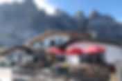
Before coming to France, I had visited Genève and the small villages around Lac Léman only once. But after I moved to France, it took me a long time to actually visit Switzerland, even though it was a country close to France. I had the opportunity to go climbing in Switzerland for the first time in 2018, and the following year (2019) I started going hiking in Zermatt and Grindelwald. Sightseeing in Switzerland is soothing to the mind because of the wonderful scenery 😍 but the high cost of living brings me back to reality 😂 This page is a memorandum about the youth hostels (2019) and camp sites (2018 & 2020) where I have stayed in Switzerland so far. 🏨 Youth hostels where I stayed (2019): 1️⃣ Grindelwald:Jugendherberge Grindelwald 2️⃣ Saas-Fee:wellnessHostel4000 Reservations were made through the website: Swiss Youth Hostels. Rates are quoted at non-member rates. If you are a member, you have to book through the members-only link website. Breakfast was included in both youth hostels, and well, the yogurt was delicious. In Switzerland, where prices are high, it is lucky that breakfast is included. The breakfast was almost the same, but WellnessHostel4000 (Saas-Fee) had a larger selection. I guess each youth hostel is slightly different. ✅ Grindelwald:Jugendherberge Grindelwald The chalet-style building was quaint and nice. The view of the Eiger (3970m) from the window was spectacular. There was a light in each bed, but there were 3 power sources around under the shared table. If power was not available in the room, there was also power in the bathroom & toilet. If you stay overnight in Grindelwald, you will receive a pass for unlimited bus rides around Grindelwald 🚌 This pass also gives you a discount on the ropeway between Grindelwald and First 🚠 ✅ Saas-Fee:wellnessHostel4000 The price included breakfast and the pool. There is also a spa, but I was told that it is an extra charge. The building itself is new and very clean, and the view from the window of Dom (4545m), the highest mountain in Switzerland, and Allalinhorn (4027m), covered with snow, was amazing. Each bed was equipped with a power supply and a light 👍🏻 🏕 Campsites where we stayed (2018 & 2020) 1️⃣ Bauernhof-Camping Wyler (2018) 2️⃣ Gotthard Camping Andermatt (2020) Campsites that could not be reserved and could not be accommodated ⚠️ Zeltplatz-Mattli ✅ Bauernhof-Camping Wyler Silvia und Adrian Thöni Sustenstrasse 32 3862 Innertkirchen This is indeed a Swiss campground. The campground was clean and surrounded by beautiful scenery. It was cozy as we pitched our tents on the grass. This campground is part of the owner's farm. During the summer months, the cows are taken to the higher altitude Alps, so it appears to be open as a camp site during this season. When I heard it was a farm, I was concerned about fecal 💩, but I didn't see any, at least not around where I pitched my tent 😆 According to Honor, she could understand a little English, and the conversation was in German. Payment was mainly in cash, which appeared to be Swiss francs. We did not inquire if Euros were accepted or if card payments were accepted. From what I saw of the people around me, they were paying in cash. I was surprised to find a toilet seat in the bathroom. The showers had hot water and cost 1 CHF for a few minutes. The campsite has an electrical plug, which is useful if you have a special connector ⚠️ For a picture of the special connector 👉🏻 see the blog of the campsite where we stayed in Fontainebleau. We were told to use a dedicated site for BBQ. I think this means no open flames are allowed. One thing that bothered me was that the campsite faces the road, so during the daylight hours there was a lot of traffic, especially from motorcycles 🏍, which I found to be very noisy. Still, by nightfall (10:00pm), there were very few cars 🚗 or motorcycles 🏍 passing by and the campsite was quiet and surrounded by mountains. The only noise problem during the night was the snoring 😴💤 coming from the tents next door 😆 ✅ Gotthard Camping Andermatt Campsite located in Andermatt (Andermatt). The wifi and showers were included in the room rate. The showers were convenient to use anytime, but wifi was only available in a limited area near the reception. Toilets had toilet seats 🚽 We used the power supply in the building where the showers and toilets are located to charge our cell phones and other devices. If you are staying at a campsite, I thought it would be useful to have a mobile battery for safety reasons. The camp site faced the road, but there was little traffic, so it didn't really bother me ⚠️ Usually this season could be full of hikers and bicycle tourists 🤔 but in 2020 it was deserted due to the new coronavirus (Coronavirus, COVID-19). I have no complaints about Gotthard Camping Andermatt, but I thought Zeltplatz-Mattli campsite, where I originally planned to stay, had a better atmosphere surrounded by mountains. I was not able to make a reservation because the campground was already full on that day 😔 By the way, when I tried to make a reservation at Zeltplatz-Mattli campground, they did not respond to me in English 😔 💶🇨🇭 Do I need cash Swiss francs when traveling in Switzerland 🤔❓ Can't I just use euros 🤔❓ On the trip (2019) where we used hostels for accommodation, I traveled without exchanging money into Swiss Francs due to the short duration of the trip ⚠️ I took Euros in cash 💶. I used the SBB Mobile App for all public transportation and paid by card at the youth hostel where I stayed. I bought food and drinks in stores (e.g. coop) and paid for everything there by card too 👍🏻 But the only time I needed cash Swiss Francs was when using the coin lockers in the youth hostel 😅 When using the lockers in the rooms of the youth hostel, the system did not require coins (cash), but the lockers we used to leave our luggage after check-out were coin operated lockers, so we needed cash 😅 I told them I didn't have any cash Swiss Francs and they were a little bit uncomfortable, although I was able to leave a small package at the front desk 😅 Most major tourist destinations do not use cash and allow payment by card, but there are occasional situations where only cash is accepted 😅 Conclusion ➡️ Swiss Franc is necessary 😅
- Via Ferrata in the Swiss Alps, Grindelwald, offers a different landscape than the Dolomites 🏔
The Via ferrata in the Dolomites in northern Italy was so inspiring that I also did it in Grindelwald, a village in the Swiss Eiger, and in Saas-Fee, a village in the valley next to Zermatt, the city of the Matterhorn 😁 What is via ferrata? It is a mountain route equipped with steel cables, ladders and other fixed anchors fixed to the rock. A “Via Ferrata” translates as “Iron Path” in English. It is more of a climbing route than a typical mountaineering route. What's good about via ferrata? Personally, Via Ferrata is less likely to get lost than regular mountain climbing because the route is wired 😁 Conversely, it is easy to stagnate because the route is fixed 😅 The Via Ferrata Season The best months for a via ferrata trip are between May and early October. Important factors are the weather as well as the operating schedules of buses and lifts.... What Equipment do I need to climb a Via Ferrata? ・Via ferrata set: a lanyard and two carabiners, used to connect the harness to the steel cable of the ferrata. A securement device specialized for via ferrata is easier to use than a simple device using a sling and carabiners of rock climbing. ・Climbing harness: ・hiking/mountaineering boots: ・Helmet: ・Via ferrata gloves: general mountaineering items, etc.... Via Ferrata climbed in the Swiss Alps 2019 Saas-Graund ⭐️ Jägihorn (3206m, K5) Panoramic Climbing ✅ Mittaghorn (3144m, K3) Climbing Route Grindelwald ✅ mini Eiger North Face : Rotstock (2663m, K2) ⚠️ Degree of Difficulty : K1=easy ~ K5=most difficult Jägihorn, 3206m, Difficulty K5 Saar Grund 🚠 Kreuzboden (2400m) ➡️ Weissmieshütte-SAC (2726m) ➡️ Jägihorn (3206m, Difficulty K5) ➡️ Kreuzboden (2400m) I thought I did my best to climb it 🚶🏻But it took me 5 hours! This was the first Via Ferrata I climbed in Switzerland. It is not as big as Tofana di Mezzo (3244m) or Tofana di Rozes (3225m) in the Dolomites of northern Italy, but it was a very hard climb for a via ferrata. The 120m long leaning suspension bridge is scarier than I had imagined 😨 I underestimated it 😂 ⚠️ There is also a route to bypass this suspension bridge, in which case Degree of difficulty : K3 I think the climbing crux is the vertical wall after crossing this suspension bridge. If you have never climbed before, you might not be able to climb it 🤔 The view at the top of the mountain is also good. So I recommend this Jägihorn route 😁 Mittaghorn, 3144m, Difficulty K3 🚠 Morenia (2550m) ➡️ Mittaghorn, 3144m, K3 ➡️ Egginerjoch ➡️ Felskinn 🚠 I thought I did my best to climb it 🚶🏻But it took me 4 hours 30 minutes! When I climbed up, it was changed to the normal setting, which is to go to Egginerjoch (2989m), over the glacier to Felskinn (2989m), and take the ropeway from Felskinn (2989m) back to Saas-Fee, probably because the lift was out of service. The course is a 180-minute walk from the summit (Mittaghorn, 3144m) to Egginerjoch (2989m) - over the glacier - to Felskinn (2989m). The regular setup seems to descend on the Plattjen (2570m) side (90min). In any case, the important point is that you need to take into account the end time of the ropeway when you walk. From the beginning to the end of the climb, it was gaseous and sometimes snowy, so it is difficult to evaluate 🤔 Climbing-wise, if you can climb about (5b) in French grade, you should have no problem. There is one place where a bolt is driven into the rock and out into space, but it wasn't that difficult climbing. What kind of views would we get if it was clear? 🤔 The route is basically a ridge climb, so it is supposed to have great views. The day we climbed, I didn't see anyone on the Via Ferrata route 😢 but many Alpine ibexes 🦌 welcomed me 🤣 Rotstock, 2663m, Difficulty K2 Eigergletscher, 2320m ➡️ Rotstock, 2663m ➡️ Eigergletscher, 2320m It took 90 nim to walk there while fully enjoying the scenery 🚶🏻 This Rotstock (2663m) North Face route is commonly known as the Mini-Eiger North Face? 🤔 Climbing-wise, it is easy. If you are a climber who has climbed (5c) in French grade, you can climb this route without via ferrata securement ⚠️ but via ferrata securement is a must, when you climb. After all, this route is for those who can't reach the Eiger North Face, but have a special attachment to it and want to experience the Eiger North Face vicariously 😁 On the day I climbed, there was a light dusting of snow in the shaded areas, the wind was blowing cold, and there were many conditions reminiscent of the North Face. So it was exciting to feel the Eiger North Face in a certain way 🤣 My personal recommendation for climbing this mini Eiger North Face is to climb Rotstock (2663m) after walking the Eiger Trail from Alpiglen station (1615m). I think you will enjoy the mini Eiger North Face more if you first enjoy the "original" Eiger North Face as much as you can on the approach and then enter via ferrata, mini Eiger North Face 🤣
- Trails in the Eiger village of Grindelwald with views of the majestic Swiss Alps 🏔 Hiking Map 🗺
When I hiked (climbed) the Dolomites in northern Italy, I was struck by the dry and rugged rocky peaks. However the snow-covered Swiss Alps (over 4000m) were somehow more elegant and simply beautiful to behold. I have rarely trekked purely in mountain villages before, and this was a great experience. This trip made me think, "If it's this great, it's not so bad to walk on the trails". Trails walked in Grindelwald, Switzerland 2019 ✅ Panorama Long rails across the High Alps Grindelwald ✅ Eiger Northface Trail ✅ Panorama Long Trails across the High Alps Grindelwald First, 2168m ➡️ Bachalpsee ➡️ Faulhorn, 2681m ➡️ Schynige Platte, 2068m I did my best to walk 🚶🏼♂️ But it took me 6:30h (including the panorama route + rest 🍱) I thought it was a great long trail with amazing views and never boring. The elevation gain is relatively small, so although it is a long trail, it is easy to walk. The hiking map received from the travel information office in Grindelwald shows the course time for the reverse pattern of the route I walked. Schynige Platte (2068m) ➡️ Faulhorn (2681m) ➡️ First (2168m) 1️⃣ Wander Hiking:6 hour 10 minutes 2️⃣ Wanderkarte:6 hour I think that a hiker who can walk this long trail in 6 hour is a very fit hiker 🤔 The scenery is beautiful, you have to take a lot of pictures along the way. Therefore it is difficult to walk as fast as the course time 😆 My favorite view on the trail 😍 1️⃣ Bachalpsee 2️⃣ Loucherhorn, 2231m 1️⃣First (First, 2167m) ➡️ Bachalpsee Finsteraarhorn (4274m) and Schreckhorn (4078m) seen over Bachalpsee were very beautiful mountain landscape. 2️⃣ Loucherhorn, 2231m ➡️ Schynige Platte The three mountains of the Bernese Oberland, Eiger (3970m), Mönch (4107m) and Jungfrau (4158m), were all visible and beautiful mountain landscape. I thought it would be fun to connect all of them and enjoy the walk, but I also thought it would be fun just to walk back and forth between them (1️⃣ Bachalpsee or 2️⃣ Loucherhorn, 2231m). In fact, many people seem to have done so. If you want to see the beautiful Alps over the lake, go to Bachalpsee, and if you want to see the three Bernese Oberland mountains, go to Schynige Platte. ✅ Eiger North face Trail Eigergletscher, 2320m ➡️ Alpiglen, 1615m It took me 2 hour to walk up the Eiger North Face Trail (including breaks) 😆 The Eiger Trail, with its close-up view of the Eiger North Face, is an unmissable trail in Grindelwald. I personally recommend this route so much that I could say I came to Grindelwald to walk "Eiger North face Trail". The course time on the hiking map I got from the Grindelwald Travel Information Center is 1️⃣ Wander Hiking:2:50h Alpiglen, 1615m ➡️ Eigergletscher, 2320m 2️⃣ Wanderkarte:2:00h Eigergletscher, 2320m ➡️ Alpiglen, 1615m I felt that the Eiger Trail route from Alpiglen (1615m) to Eigergletscher (2320m) is more impressive because you can see the Eiger North Face from the beginning. But it will take you longer time because the route is an ascent. If you walk the Eiger Trail from Alpiglen (1615m) to Eigergletscher (2320m), you may want to connect the Jungfrau Eiger Walk as an option, although I personally have not walked it. Jungfrau Eiger Walk Eigergletscher, 2320m ➡️ kleine scheidegg This route is a well-maintained hiking route with a lake reflecting an upside-down Eiger. The course time on the hiking map I got from the Grindelwald Travel Information Center is 1️⃣ Wander Hiking:1 hour 2️⃣ Wanderkarte:1 hour Eiger Trail ➡️ Jungfrau Eiger Walk ➡️ walk to Kleine Scheidegg station and hang out at a restaurant course 🍺 is amazing 😂 It will definitely be a great trekking route 🤣 From the restaurant at Kleine Scheidegg station, the three mountains of the Bernese Oberland, Eiger (3970m), Mönch (4107m) and Jungfrau (4158m) are beautiful and breathtaking. After walking the Eiger Trail and seeing the huge Eiger North Face up close, the sunset view of the Eiger (3970m) back in the village of Grindelwald will be 3 times more beautiful than before! 1️⃣ Wander Hiking 2️⃣ Wanderkarte
- Alpine trail along the ridge from Gornergrat, a truly spectacular panorama ahead with the Matterhorn
Alpine trail along the ridge from Gornergrat (3089m) through Hohtälli (3286m) to Stockhorn (3532m), which is not just a walk, an alpine trail. On the map the course looks short...in fact not really 😂 But we can see the summits from a different angle and we are fascinated by the spectacle of the glaciers that unfold their folds. The really beautiful alpine trail is a truly spectacular and breathtaking panorama ahead with the Matterhorn (4478m) 😍 The Matterhorn (4478m) is viewed to perfection from here. The ridge from Gornergrat (3089m) to Stockhorn (3532m) After leaving the Gornergrat station (3090m) and skirting the Gornergrat Kulm Hotel on the left, the path leaves the buildings and heads towards the Hohtälli (3286m) which is seen ahead. The route soon ascends to the right to easily gain the ridge of the Hohtalligrat. Along the way, there is a path leading to the Monte Rosa hut. The ridge of the Hohtalligrat will be narrower than this path, but always straight ahead on a path that can be easily followed. A good path leads to the summit of the Hohtälli (3286m, ski lift). Further along the ridge from the cable car station on the Hohtälli (3286m) is Stockhorn (3532m), but the way beyond here stops being just a walk. Extreme caution is required. When I arrived the signpost says "Stockhorn 3532m", I saw clearly that I was not on the summit... 🤔? In the distance I could see what appeared to be the summit. I think there are still 40 minutes ? to go the summit..... I decided to abandon the trip and return to Zermatte, as I would have no transportation to my next accommodation if I continued on 😢 On the way back, I walked down Stockhorn (Stockhorn, 3532m) ➡️ Gornergrat (Gornergrat, 3089m) ➡️ Riffelsee (Riffelsee) ➡️ Zermatt (1620m) at once, but it was too hard on my knees and it was a mistake 😓 I should have at least taken the mountain railway from Riffelalp (2211m), because from Riffelalp (2211m) I have to walk through the forest and cannot see the Matterhorn (4478m). ✅ PANORAMIC MAP Hiking maps distributed by the Zermatt Tourist Information Center. This is a simple hiking map. ✍🏻 I hope you can visit this trail in the best season, on a clear day with no wind 😉 All photos presented here were taken by myself with my iPhone while walking this trail 😊
- Fontainebleau, France, a great place for even beginners for Bouldering. Guidebooks & Accommodations
Fontainebleau is the best bouldering area in Europe, located 90 km South-Eas of Paris, about an hour away. If you like bouldering, or if you play boulder at least once a week, you should go to Fontainebleau at least once in your life. No climber, no matter their discipline, should miss out on a chance to visit the Bleau Forest. I have had three opportunities to boulder at Fontainebleau. Here is a brief memorandum of my impressions of those times. Bouldering sites at Fontainebleau Fontainebleau set in beautiful forested location and contains over 35,000 boulder problems in 271 ares. The Rocks are superb sandstone. The Boulder Season The best time to boulder is the spring and the autumn. The summer (from mid July to mid august) is hot, though it is possible to find rocks that are in the shade. I recommend a spring as you can see Fontainebleau in all the glory of spring. But you can climb at any time of the year. It's only the rain that will stop you. Fontainebleau Guidebooks 1️⃣ Fontainebleau Fun Bloc (Jingo Wobbly, Font Bloc volume1) 2️⃣ Fontainebleau Top Secret (Jingo Wobbly, Font Bloc volume2) 3️⃣ 5+6, 4862 straight ups in central Fontainebleau 4️⃣ 7+8, 3748 straight ups in Fontainebleau There are several topos for bouldering. Before I went to Fontainebleau (2015), I bought a "Fontainebleau (Magique)" because it was the only one available at my local mountain gear store. It was a topo that showed the location of the rocks, but did not give any details of the route, basically the route of "The Unique Circuits". The best time to boulder is the spring and the autumn. The summer (from mid July to mid august) is hot, though it is possible to find rocks that are in the shade. I recommend a spring as you can see Fontainebleau in all the glory of spring. When I went to Fontainebleau, I tried easy "circuit course" as a warming-up, but it was surprisingly fun 😁 Follow the arrows and climb the rocks. There are traverse challenges, a little overhang wall, and of course climbing down 😂 However, Fontainebleau (Magique) was not usable enough as a bouldering topo. 1️⃣ Fontainebleau Fun Bloc (Jingo Wobbly, Font Bloc volume1) This topo is very easy to understand, with photos and route descriptions (grades, etc.). If you are not that picky and just want to enjoy bouldering (not circuits), this topo should be enough (30.9€ in November 2015). 2️⃣ Fontainebleau Top Secret (Jingo Wobbly, Font Bloc volume2) Fontainebleau (Top Secret) has the same structure as Fontainebleau (Fun Bloc). My personal feeling is that I bought Fontainebleau (Fun Bloc) as my first book and Fontainebleau (Top Secret) as my second book. Because on our Fontainebleau bouldering tour, we also went to areas that are not in Fontainebleau (Fun Bloc) but are in Fontainebleau (Top Secret). Maybe there was a problem with the area we went to. The route itself was interesting, but the areas listed in Fontainebleau (Top Secret) are dotted with enjoyable routes, so it was relatively difficult to move from one area to another. Unlike the areas in Fontainebleau (Fun Bloc), the approaches to them were unexpectedly difficult to grasp and it was easy to get lost. On the other hand, there are relatively few climbers, so it may be a good choice for those who want to devote themselves to the route quietly 🤔 3️⃣ 5+6, 4862 straight ups in central Fontainebleau 4️⃣ 7+8, 3748 straight ups in Fontainebleau Personally, I find this topo very confusing. There are many routes covered, so maybe people who are used to going to Fontainebleau can use it. Access to the Bouldering Area Many of the major bouldering areas have parking nearby. That often means you don't have to walk far. The main area and other areas are also connected by small paths that cross the forest, making it relatively easy to get around. Climbing Equipment ・bouldering crash pad ・shoes ・chalk ・brushes Fontainebleau Grading The Fontainebleau grading system was pretty tough for me. For example, some tasks such as (6a) were climbed crisply, but even (5a) couldn't be climbable. Even with a grade of (5c), it takes really strong mental control to attempt a 5m high slab challenge by Onsight. Go with routes which feel good for you, regardless of the grading. Many of the routes are in close proximity to each other. If, after climbing, the experiential grade is too different from the topo grade, maybe you can check the Bleau.info website 🙄 The climbing areas I climbed at Fontainebleau (2015 & 2018) Topo : Fontainebleau (Fun Bloc) 1️⃣ CUVIER (Bas) 2️⃣ Isatis, Franchard (En Bas)・Isatis, Franchard (Côte)・Isatis, Franchard (Est) 3️⃣ 95.2 (Centre)・95.2 (Nord)・95.2 (Sud) 4️⃣ Apremont (Chaos) 5️⃣ CUISINIÉRE (Centre) 6️⃣ Èléphant (EST) Topo : Fontainebleau (Top Secret) 7️⃣ FRANCHARD RAYMOND 8️⃣ Cuvier Rempart 9️⃣ Dame Jouanne Depending on the season and weather, I personally recommend the following areas in the area we climbed 1️⃣ CUVIER (Bas) 2️⃣ Franchard Isatis I think 🤔 it's close to the parking lot and there were plenty of challenges to enjoy 😊 🏡 Accommodations 🏕 🏨 I have had three opportunities to boulder at Fontainebleau, staying at the hostel in November 2015 and at the camp site & at the friend's Gite in April 2018. 🏨 Fontainebl’hostel (November 2015) The owner, Patrick, speaks English, so if you don't understand French, that's not a problem. The room we stayed in had 3 bunk beds with shower and toilet. It is a so-called dormitory style. There is a kitchen in the common space, which we could use freely. There is also a refrigerator, and plates, cups, forks & knives are available for free use. There are also showers and toilets in the common area. If you don't have a car, Patrick can pick you up and drop you off at the climbing area and/or at the station. Climbing crash pads are available for rent. Please check with him, for rates, etc. For other information, the tourist information office at the Fontainebleau Avon station has discount coupons for Fontainebl'hostel (2015). If you are looking for a simple stay in Fontainebleau, I think the rooms are clean and there is no problem. I would also recommend this accommodation for those who want to experience bouldering at Fontainebleau while sightseeing in Paris. Fontainebleau Campsite🏕 🏕 Camping Les Prés (April 2018) This campsite "Camping Les Prés" was chosen by my climbing friend 👱🏻🇫🇷 and I don't know why he chose it, but I have no complaints about it. The lady at the reception desk speaks French, of course, but she also speaks easy-to-understand English, so it is not a problem if you do not speak French. At this time of year (April 2018), the Camping Les Prés office was open in the morning from 9:00-12:00 and in the afternoon from 15:00-19:00. If you want to use the camp site WiFi, it was extra. The camp site Camping Les Prés sold several kinds of bouldering topos such as Fontainebleau (Fun Bloc). Bouldering mats (Crash Pads) and brushes were also available for rent (ask in advance for details). We bought a little water (1.5L x 6) at the supermarket for drinking, but basically we used the tap water at the camp site for cooking and drinking. I used the shower at midnight (1:00 am), but hot water still came out 😁 What about the high peak season ? 🙄 If I had to raise a problem with this campsite, it would be the toilets. As is normal in Europe, there were no toilet seats at this campsite either. When barbecuing, we were told to use the barbecue-only site in the camp site. I think it is prohibited to have an open fire on the lawn. It was two places to grill. This time it was just us to use this site, so there was no problem, but I wonder how it would be during the Summer Vacation Season? As for the power supply, I think it would be useful to have a plug for the outlets that are commonly used by people traveling in campervans. If you have this plug, you would be able to comfortably charge your cell phone and other devices during evening meals. This special plug can be purchased at the camp site. If you don't have this special plug, you can use a headlamp or similar as you would normally do when camping. As for charging cell phones, there is a power outlet in the bathroom next to the toilet, which is commonly used in France, so it was possible to use it. 🏡 gîte at Fontainebleau If you want to stay like you're living in France, check out 👉🏻 Gites de France For the third time, I stayed at a gîte-like place in Fontainebleau. It was a rental house of an acquaintance of a climbing friend, so the situation was a little different from a regular rented gîte. In the morning we had a leisurely meal with the owner and then went to climb Fontainebleau 😊 ✍🏻 List of climbing routes which I have climbed 👉🏻 Fontainebleau, France 🙈
- Recommended Routes climbed in the Dolomites, the birthplace of Via Ferrata & Topo actually used 📚
This (September 2015) was my first time in the Via Ferrata. I mean, it was my first time in the Dolomites, my first mountain climbing trip abroad and my first solo mountaineering trip including in Japan. I was a bit worried at the planning stage 😕 but the weather was great and I was able to enjoy the Via Ferrata ☀️ If I don't find a climbing partner, I'm thinking "maybe via ferrata again 🤔" What is via ferrata? It is a mountain route equipped with steel cables, ladders and other fixed anchors fixed to the rock. A “Via Ferrata” translates as “Iron Path” in English. It is more of a climbing route than a typical mountaineering route. What's good about via ferrata? Personally, Via Ferrata is less likely to get lost than regular mountain climbing because the route is wired 😁 Conversely, it is easy to stagnate because the route is fixed 😅 The Via Ferrata Season The best months for a via ferrata trip are between May and early October. Important factors are the weather as well as the operating schedules of buses and lifts.... Guidebooks 📚 The Dolomites : Rock Climbs and Via Ferrata This topo is mainly about climbing routes, and there are countless Via Ferrata routes that are not listed in the topo. If you look at a Hiking Map, you will see that there are mountains everywhere that can be climbed with via ferrata! What Equipment do I need to climb a Via Ferrata? ・Via ferrata set: a lanyard and two carabiners, used to connect the harness to the steel cable of the ferrata. A securement device specialized for via ferrata is easier to use than a simple device using a sling and carabiners of rock climbing. ・Climbing harness: ・hiking/mountaineering boots: ・Helmet: ・Via ferrata gloves: general mountaineering items, etc.... Via Ferrata climbed in the Dolomites 2015 ⭐️ Punta Anna (VF5C) ~ Tofana di Mezzo(3244m) ✅ Ski Club 18 (VF5B) ⭐️ Giovanni Lipella (VF4C) ~ Tofana di Rozes(3225m) ✅ Sentiero del Curato Militare Hosp (VF2A) ⭐️ Sentiero de Luca/Innerkofler (VF2B) ✅ Piz da Lech (VF3B) ✅ Piz da Cir V (VF2A) ✅ Gran Cier (?) ⭐️ Punta Anna (VF5C) ~ Tofana di Mezzo (3244m) Via Ferrata in Punta Anna (VF5C) is very scenic and exposed. Overall, this route was the most interesting one I climbed on Via Ferrata trip (2015) 🙂 If you want to climb a long Via Ferrata, Punta Anna (VF5C) is your target. Punta Anna (VF5C) consists of two main sections. 1️⃣ the Giuseppe Olivieri Ferrata (Rifugio Pomedes, 2303m ~ Punta Anna, 2731m) 2️⃣ the Gianni Aglio Ferrata (Punta Anna, 2731m ~Tofana di Mezzo, 3244m) Starting from Rifugio Pomedes (2303m), the ascent to Tofana di Mezzo (3244m) has an elevation gain of 941m. I climbed the route by connecting the two sections, but after first section, "Via Ferrata Olivieri", it is possible to use the escape way to descend to the "Rifugio Giussani". Many people seem to climb only the first section. In fact, the other people who were staying at "Rifugio Pomedes" were only up to the first section. Sure, climbing-wise, the first section is the much fun part. But if you are ready for a very long Via Ferrata .... ✅ Ski Club 18 (VF5B) This route was the first Via Ferrata in my life. It is a short route, but it is the most climbing-oriented route I climbed on Via Ferrata trip (2015). I arrived at Cortina D'ampezzo that morning, left my luggage at the luggage storage in the bus terminal 🛄, changed in the bathroom 🚻🚾, then started climbing before noon 😄 The route is in full view of people coming up by ropeway, so people call out to me after the climb ☺️ ⭐️ Giovanni Lipella (VF4C) ~ Tofana di Rozes (3225m) The difficulty level (Grade) of Via Ferrata is not so high, but the route is long and there is no lift for descent, so you need to walk on your own. In terms of scale, it is not much different from Punta Anna (VF5C), but it requires considerably more endurance than Punta Anna (VF5C). My personal impression is that Giovanni Lipella (VF4C) is more mountaineering than Punta Anna (VF5C). That day (2015) I started from Rifugio Dibona (2083m) and walked at a pace that allowed me to return to Rifugio Dibona (2083m). However, Rifugio Dibona (2083m) was fully booked, so I did not return to Rifugio Dibona (2083m) and stayed at Rifugio Giussani (2600m) on the way. If the choice is possible, I recommend staying at Rifugio Dibona (2083m). The food at Rifugio Dibona (2083m) is very delicious 😋 ✅ Sentiero del Curato Militare Hosp (VF2A) We originally planned to climb Delle Scalette (VF3B), but since it was off limits, we decided to climb the descent route (Sentiero de Luca/Innerkofler (VF2B)) used after climbing Delle Scalette (VF3B). The route is short and gentle, so maybe a good way to practice via ferrata! ⭐️ Sentiero de Luca/Innerkofler (VF2B) Luca/Innerkofler (VF2B) is the best route to view Tre Cime. The most classical Via Ferrata to visit the Lavaredo area. This Via Ferrata was built in World War I and passes hundreds of meters through the mountain interior 🔦 This route is on the other side of "Curato Militare Hosp (VF2A)" across from Rifugio Locatelli (2405m). It is an easy route in terms of Via Ferrata, but the views along the way are spectacular. This is one of my recommended routes. ✅ Piz da Lech (VF3B) I wish the route was longer. The day I climbed the weather was bad 🌥 The view was not so good 😞 but if it was sunny ☀️ Piz Boé (3152m) and Marmolada mountain range should be visible 🤔 Maybe I can recommend this Piz da Lech (VF3B) ....... ✅ Piz da Cir V (VF2A) The approach to the climb was a bit confusing. Maybe it is a good route to experience via ferrata 🤔 I used the ropeway that day 🚡 but maybe it is a good climb if you walk from the bus stop 🤔 ✅ Gran Cier (2592m) Although it was not in the guidebook I brought with me, Gran Cier, next to Piz da Cir V, might be a good route for beginners to practice Via Ferrata 🤔 There was a man climbing in a normal climbing style without Via Ferrata equipment. I used "Rifugio" 👉🏻 Which Rifugio would I recommend?
- The first mountain hut “Rifugio” I stayed at was in the Dolomites, the birthplace of Via Ferrata ⛰🏫
The "Rifugio" I used on my first Via Ferrata to the Dolomites was more like a dormitory-style hostel. Unlike Japanese mountain huts, the "Rifugio" in Italy were comfortable, with individual beds assigned to each person. Basically, Italian "Rifugio" seem to have the HB (Half Board) system. What is HB (Half Board) ? Accommodation fee Dinner Breakfast are included in the HB price. Dinner is usually two choices from the list (pasta, meat, etc.). Personally, I felt that there were two main courses. Bread, salad, and dessert are also included. Drinks are extra charge at all Rifugios. Water from the faucet may or may not be drinkable depending on the Rifugio. The beds have thin blankets but no sheets, so you need something like a sleeping bag cover. Of course, they seemed to sell simple sheets. This time I went to the Rifugio without any reservation at all. But it seems that basically all guests have a reservation. There is a discount if you are an Italian Alpine member. Rifugio Pomedes (2303m) My first experience with Rifugio was at Rifugio Pomedes. It was like a Japanese mountain lodge. The only difference was the beds. The beds were in an irregular bunk style. You can use the shower if you pay. My roommates, a group of Italians and a taciturn American, were also mountain lovers. We started talking about the mountains and even talked about the US presidential election (2015) 😁 This is the Rifugio with the best view of all the Rifugios I stayed at this time. So I highly recommend it. Rifugio Dibona (2083m) It was more like a dormitory style hostel. The room was bright and clean. I was told by my roommate that the water in the washroom was drinkable (or at least safe for her to drink). The food was the best among all the Rifugio I stayed in this time (2016) 🥗🍝🍖🍺 As it seems to be a popular Rifugio, I was refused to stay on Saturday night because it was fully booked 😢 Rifugio Giussani (2600m) The taste of the food is average, but not great compared to the other Rifugio. I have no complaints, but compared to other rifugios, it was disappointing. The beds were pipe style metal frame bunk bed. I personally had no complaints. The water was not drinkable as I believe it was rainwater that was stored and used. The owner and his wife were nice people. A taciturn American I met in Rifugio Pomedes liked them so much that he spent two nights here walking in the surrounding mountains. Rifugio Auronzo (2330m) The most famous Rifugio in the Dolomites ? The facility is large and the food is cafeteria style. You line up with a tray. You can choose two of your favorite dishes while looking at the real thing. Of course, bread and dessert are included. The calories are huge. I personally think it is enough for two people 🤣 The croissant in the morning was good, but it was very sweet with chocolate 🥐🍫 Rifugio Auronzo does not have the family atmosphere typical of mountain lodges, but it is not a hostel either. I would stay at Rifugio Auronzo again. Rifugio Kostner (2500m) The room was the nicest of all the Rifugio I stayed in, with fluffy bedding and a power outlet conveniently located near each bed. The view is nice, but the mountains don't seem to loom over you and it might be a bit lonely. The people staying there were friendly and the atmosphere was very nice. The water outside the building is melted snow water, but it is drinkable (at your own risk).
- Arco is my first climbing site in Italy. It is famous for “Rock Master” 😁 Topo & Accommodation 🏠
The town of Arco is a small village about 5 km north of Lake Garda (Lago di Garda), a famous luxury resort in northern Italy. Arco is a town that only climbers know, but it is famous for Rock Master Competitions! The area has an amazing combination of a beautiful scenery with lakes and olive fields, Climbing sites in Arco The Arco area has more than 136 climbing spots and more than 5200 routes. Arco is mainly short pitch climbing which is bolted sport climbing routes across all grades on limestone rock. My impression is that Arco is a single pitch climbing area, but there are also many multi-pitch climbing areas. Climbing Equipment ・single rope 70m ・12 quickdraws Depends on the route you want to climb.... The Climbing Season The best climbing seasons are spring and autumn, and summer is too hot to climb. However, as it is a famous summer resort, most people come here from late June to mid-September when they are on vacation. So it seems to be crowded during the summer vacation period. Even if it rains in the Dolomites (Dolomiti) in northern Italy, which is famous for climbing and trekking, it is sometimes possible to climb if you come to Arco. Rock Climbing Guidebook The climbing route descriptions are not the ones with route lines drawn on the photograph, but simple pictures of rock formations with route lines drawn on them. The topo compactly contains access and other necessary information such as exposure, equipment, parking, fit for family… ⚠️ 4th Edition (2018) is available now. Access to the Climbing Area Most of the crags around Arco are easily accessible. Massone, Arco's most popular climbing area, is within walking distance from downtown Arco. Climbing with a mountain guide (Friends of Arco) I had been in France less than a year and did not have a climbing partner, so I signed up for a mountain guide. This was my first time climbing with a mountain guide. There are several climbing guides available, and this time I asked Friends of Arco to guide me. Depending on the season, there is a climbing school during the summer season, and it seems to be reasonably priced (80€~/3days, 2012). I exchanged only one email in advance and negotiated directly on site on the day I arrived at Arco. It would be best if you can speak Italian, but my limited English was fine. The meeting place was Camping Arco. Maybe Camping Arco and Friends of Arco are the same organization. The climbing areas I climbed inArco (2012) Day 1 : Nago Day 2 : Nomessino This was my first time in Arco. The weather was not perfect 🌦 But the climbing route was nice 😍 Day 1 : Nago Since it was my first time on the Arco crag and my first time on limestone, I drove with a mountain guide to Nago, which has a moderate number of easy routes. Day 2 : Nomessino It was raining lightly so we went to Nomesino, a slightly overhang area in the Rovereto. It is an area where local climbers can climb even on rainy days 🌧 Climbing Shops in Arco The whole town area in Arco is full of mountaineering shops 😂 The main street of Arco is lined with climbing stores. Some of the prices are discounted, making it twice as enjoyable for climbers. Having had a taste of Arco, I assumed that I could get climbing equipment at a lower price in a city where climbing is popular (e.g. Kalymnos, Greece), but it seems that Arco is special 😔 Accommodation 🏠 La Porta del Cuore This is an apartment type accommodation. I used the website to make the reservation. The owner was friendly and helpful, and I would use Appart again. All the dishes were provided, including a wine opener. There was a refrigerator and oven. ⛺️ Camping site Camping Zoo Arco Camping Arco is conveniently located near Arco city center. How to get to Arco from Venezia by public transportation 1️⃣ 🚃 Take a train from "Venezia S. Lucia" to "Rovereto" via "Verona Porta Nuova" 2️⃣ 🚌 Take a bus from Rovereto-Via Manzoni to Arco (Arco). I think you can take a bus from in front of Rovereto station, but this time I took the bus from the first bus station (Rovereto-Via Manzoni) 😅 ✍🏻 List of climbing routes which I have climbed 👉🏻 Arco 🙈
- Multi-pitch climbing in “Les Calanques”, a beautiful national park in France & climbing guidebook 📚
The Calanques (Les Calanques 🇫🇷) is a 20 km stretch of coastline from Marseille to the small port town of Cassis. When I ask my French climbing friends about Calanque's impression, everyone says it's a beautiful place. The deep coves, cobalt blue Mediterranean Sea, and white cliffs are beautiful not only for climbers, but also for all visitors. It is also a perfect place for swimming, kayaking, sailing, or trekking..... around Calanques. The Calanques has been designated a French National Park since 2012. This time, march 2016, is my second calanque since 2013 and it is always beautiful. It is "The European Climb" as I personally imagine it. Blue waters and white limestone cliffs. Even if you can't climb it, even if the approach is long, you will be very satisfied with this view. Climbing sites in Les Calanques 1️⃣ Marseilleveyre 2️⃣ Les Goudes 3️⃣ Melette 4️⃣ Sormiou 5️⃣ Morgiou 6️⃣ Luminy 7️⃣ Gardiole 8️⃣ En Vau We climbed En Vau, Luminy, Morgiou and Sormiou in 2013 and En Vau, Morgiou and Sormiou in 2016. Although the approach is difficult, En Vau has some easy multi-pitch climbs and is a beautiful climbing area with the feeling of being surrounded by sheer cliffs and looming rock. Climbing Equipment ・Single rope 70-80m ・double rope 50-60m ・minimum 12 quickdraws Depends on the route you want to climb.... If you have a double rope 60m and at least 12 quickdraws, you may be able to climb most routes 🙄 At least, I had no problem on the routes when I climbed. The Climbing Season I think it is too hot to climb in the summer unless you choose the right area. Deep water solo climbing 🤣? Access to the Climbing Area Les Calanques are not allowed to drive to the ports of Morgiou or Sormiou during the summer (exceptionally, those who have booked hotels along the port). It takes 1-2 hours to walk from the parking lot to the harbor during the summer months, so it may be better to remove the summer months for climbing at Les Calanques (Calanques). That said, the nearest parking lots to En Vau and Luminy remain the same throughout the year, so it's hard to say. Also the Colline de lun area in Sormiou, where we climbed this time, is at the entrance to Sormiou, so parking is the same throughout the year. You can get information about parking and other information from ➡️ this site 📡 Rock Climbing Guidebooks LIVRE TOPO ESCALADE LES CALANQUES 2022- FFME It was hard to understand the approach, perhaps because of the French language. But come to think of it, a French climbing friends of mine were lost, so it was not a language problem. There are similar crags, so you need to be careful, but once you get to the area you want to climb, it was relatively easy to understand the climbing routes because they have pictures of them. Climbing Grades For single-pitch climbing, personally, up to (~5c+), I find it difficult in terms of experience. Up to (6a~7a) is, well, reasonable. I don't know about (7a+) and above, as I haven't climbed them yet. When multi-pitch climbing marginal grades, it may be a good idea to double-check the grade on the website. There have been routes that I have climbed where the grade was clearly harder than the topo grade, and when I checked the website later, it was the grade I felt I was getting. When rappelling back down, use only the assigned route (the route with the rappel station) Multi-pitch climbing in Les Calanques (Morgiou : Crêt Saint Michel) La Paroi Noire (3b・4b・4c・4a) We originally planned to climb La Tout Droit next door, but made a mistake because the topo and the actual start of the route were misaligned 😐 This route was affordable and someone was climbing all day long. Eperon de Droite (4b・5c・5c) The second pitch, I was thinking "(5c) is too hard for me ", the website says (6a+) 😅 No wonder maillon was hanging in two places 😂 🏠 Accommodation ⛺️️ Campsite Camping Les Cigales (43 Avenue de la Marne, 13260 Cassis) ☎️ 04 42 01 07 34 ⛺️ Ouvert du mi-mars au mi-novembre There are several camp sites around Calanques, but Camping Les Cigales is recommended because it is close to the climbing area. We stayed there for a week in May 2013. It was relatively crowded during this season. I guess the problem is the showers in the evening. The temperature was sometimes cold, perhaps due to the large number of people using it. The toilets had no toilet seats and we had to bring our own paper. There was a power supply in the sink (French type) and it was possible to charge your phone, etc. Camping Les Cigales is more than 30 minutes away from the campsite (3 star, I think?) with poutes. We stayed one night at Camping Les Cigales, but personally, Camping Les Cigales was enough for me considering the price, etc. 🏠 Accommodation In March 2016 we used accommodation (airbnb). We stayed in an accommodation (airbnb) near the port city of Cassis for 4 days and 3 nights with 5 people for 91€ / one person. Accommodation (airbnb) is comfortable as long as the key is handed over well. Supermarket Auchan Aubagne en Provence branch, address;13400 Aubagne It seems to be open until 21:30 on weekdays. ⚠️ I recommend you to check the internet in advance. The SPAR and the bakery in Cassis are open on Sundays. ✍🏻 List of climbing routes which I have climbed 👉🏻 Les Calanques 🙈
- Looking back on Climbing in the Climbing Paradise of Kalymnos, Greece 🇬🇷 Accommodation 🏠 Topo 📚
Kalymnos is a small island in the Aegean Sea, which is the fourth largest island in the Dodecanese. Kalymnos sponges are very famous. For climbers, Kalymnos is a paradise 😍 There are plenty of limestone climbing sites and more than 3,400 sport routes. I went climbing alone to Kalymnos during my late summer vacation in 2014. Before I left, I was worried if I would be able to climb (or find climbing partners) in Kalymnos alone, but everyone was warm and welcoming 😃 The first day I went to the climbing area without an appointment and looked for a partner on the spot. On other days, I used the website 👉🏻 CLIMBING PARTNER NEEDED! I guess it depends on the season, but I found that there are more climbers who come to kaymnos alone or looking for partners than I expected. The downside of climbing with new people is that there is more risk than when climbing with a group of like-minded climbers. Personally, I had no complaints about the climbers I met this time. However, when talking to them, it seems that some of them do not belay well. The beauty is that you can meet climbers from many different countries. This time I made friends with climbers from France, Sweden, Finland, Canada, Italy, and Norway. I enjoyed listening to their stories about climbing, economics, life, and many other topics. At first day I didn't know anyone at all, but after about a week, I started to meet people I knew when I walked around town. Then the chain of acquaintances of acquaintances spread, and I was in a state of "uhhhh, who was it 🤔” 😂 Climbing Guidebook You can find the topo at any store in Masouri or website 👉🏻 climb Kalymnos Kalymnos climbing guidebook (2019 Edition) My topo is old (2010), but a revised version was released (2019 Edition). There are some new routes that are not listed in the topo, so it is recommended to check the website (Kalymnos New Route List June 2014) and print it out. If you forget your pudding, you can buy it at the store in Masouri (5€). Climbing Equipment ・single rope 80m ・14-20 quickdraws Depends on the route you want to climb.... I think the route I tried was maximum 14qds (not including the end point) 🤔 There were often two carabiners at the end point. Of course not on all routes. Approach From Masouri, the popular areas of Grande Grotta and ODYSSEY can be reached on foot. Telendos Island is accessible by boat, but it is only a 10-minute walk from Masouri to Myrties Harbour. Other areas are accessible by bike, car.... Season & October Climate The best months for climbing are October, November, April, and May. During this climbing tour (2014.10.11 - 10.20), it was hot when the sun shone (<25°C), but a little chilly in the shade. I wore a fleece when belaying. The time of climbing depends on the area, but I recommend climbing in the morning (before about 2pm). In the afternoon, many areas are exposed to the sun. About the Climbing Routes The routes on Kalymnos are relatively well bolted and I found the grades to be more lenient than the topo description. I think this is a consideration to prevent accidents as much as possible, since climbing is a way of making a living on this island. Among the numerous routes, I recommend trying the ones that appeal to you, regardless of grade. 🏠 Accommodation Pantelis Studios I sent about 10 emails around mid-August and only got about half of the responses. They all said they were full until the end of October. Only Pantelis Studios was available (20€/day). This seems to be due to the fact that LCC airlines are flying to Kos until the end of October. The beds were made daily, but there was no change of towels and no soap, no shampoo, no toothbrushes ... There were dishes, but no bottle opener. There were one or two mosquitoes every night. I later found out that there were similar "INSECT-REPELLENT ?" in the rooms. I have no complaints about Pantelis Studios, but it seems that there are cheaper and better Studios. Laundry It seems that even long-term residents wash their clothes by hand. You may be able to ask the owner to use the washing machine 🙄 I was told later that there is a laundromat? 🙄 mini supermarkets & Restaurants 🍖🍺 There are several mini supermarkets in Masouri, so it is possible to cook for yourself. The sauce used for pasta may not be suitable for Japanese palates? Fresh fish and meat may not be available? If you go to the next village, you can find Super market Smalios, which sells meat. Fish? For vegetables, I recommend the mobile grocery store that comes to Masouri. Be aware that the water coming out of the tap in your room is "salt water". There are two places to get plain water in Masouri. As for restaurants, Miltos, Aegean, Smugglers, etc. are recommended? Airline ✈️️ Fly to Athens, then fly directly to Kalymnos I flew from Athens to Kalymnos by plane (Olympic Air). The airfield in Kalymnos is smaller than the one in Kos, so only small planes (36-seater) are allowed to fly there, which is vulnerable to wind. Flights to Kalymnos may be cancelled on very windy days. The day we were returning, it was so windy that my fellow climbers invited me to go climbing, saying, "Maybe we won't fly, huh?" Fortunately, it was a northerly wind and we were able to fly with no problems. ✍🏻 The airline currently (2022) flying the Athens-Kalymnos route is Sky Express. Kalymnos Airport ↔️ Masouri 🚕 2014 I used cab 🚕 It cost 15€ from the airport ✈️ ➡️ Masouri 🏖 It cost 20€ from Masouri🏖️ ➡️ airport ✈️ Impressions of Masouri Masouri is a funky town with noisy motorcycles in the morning, but Grande Grotta and ODYSSEY are very convenient to walk there. If you want to stay in a quiet place, it might be better to stay off the main road, on the mountain side, or a little outside the main town. I didn't have time to visit the museum in kalymnos this time, but it is worth a visit. It was a great climbing area that I would love to return to the island if given the chance 😍 The climbing areas I climbed in Kalymnos (2014) This was my first time in Kalymnos. It was good 🌤 Nice atmosphere and nice view, nice route 😍 Day 1 : Afternoon ➡️ SPARTAN ➡️ SPARTACUS Day 2 : Telendos Island Day 3 : POETS ➡️ IANNIS Day 4 : ODYSSEY Day 5 : KALYDNA Day 6 : REST 🏊🏻🏖🌊 Massouri Beach Day 7 : SIKATI CAVE Day 8 : Grande Grotta ➡️ PANORAMA ✍🏻 List of climbing routes which I have climbed 👉🏻 Kalymnos 2014
- Yes, You're Right. We have to go to Frankenjura, if we want to climb in Germany. It was too hot 🥵😂
Frankenjura is one of the biggest climbing region for climbing in Germany. It is located northern Bavaria, between the cities of Nuremberg, Bamberg, and Bayreuth and approximately 1,000 crags spread out in a beautiful forest. Especially the world’s first 8c (Wallstreet) and 9a (Action directe) are very famous among them. Frankenjura is something for climbers of all abilities, not only top climbers but also beginners and intermediate climbers. The majority of the routes at Frankenjura are short powerful single pitch sport routes on excellent quality white and grey limestone rock, that is full of finger pockets and holes 👆🏻 Incidentally, the redpoint concept was born in Furankenjura. Climbing sites in Frankenjura My impression of Frankenjura was that the areas looked like Japanese climbing areas, as most of the cliffs were strewn in the forest. The climbing routes were relatively short and hard. "Would you call it bouldering-like?" "Maybe not so much?" Either way, it felt short and difficult. But Fun! The Climbing Season The climbing season is from April to the end of October. The optimum time to climb at Frankenjura is from June to September. Most of the crags are situated in deep woods that mean climbing is agreeable during the whole summer. But... We went to Frankenjura early in August 2015. That was an unusually hot summer, with temperatures reaching as high as 35°C. We felt very hot even even in the forest 🥵 As local climbers told us, the temperature at that time was only once or less in a year. In any case we could enjoy climbing in Frankenjura 🤣 The crags are scattered all over the area, you can go to a lot more places than just one area, during the day depending upon the sun and heat etc… Access to the Climbing Area The crags are scattered and it was sometimes very difficult to reach the desired area. However, the internet is much better these days than we went to there at 2015, and I think (hope), you can get to the climbing area without getting lost. If you're worried about battery life... If you can, I recommend carrying a detailed map (kampass Wander : 170 & 173). Climbing Equipment ・rope 70m ・12 quickdraws Depends on the route you want to climb.... You could probably climb most routes 🙄 At least, it was not a problem on the routes we climbed. In the most cases a rope of 50m is absolutely sufficient. But some cliffs are higher than 30m. Perhaps this is common to all climbing areas in Germany, Frankenjura is no exception, and there were some routes where the distance between bolts was quite far. Bring some cams and nuts, slings, that will be helpful sometimes. Even on the easier routes, the first bolt is not found until about 5m into the climb, and sometimes the run out along the way is amazing 😂 📚 Rock Climbing Guidebooks Franken 2 There are two books in different languages 1️⃣ German (only) version 2️⃣ Topo described in both German and English. The German/English topo is thicker and has two volumes (vol1.2). Action Directe (UIAA 11, Waldkopf) is in the (vol.2) topo. The climbing areas I climbed in Frankenjura (2015) Day 1 : Großenoher Wand Day 2 : Grüne Hölle Day 3 : Zimmerbergwände ➡️ Stadeltenne Day 4 : Waldkopf ➡️ Krottenseer ➡️ Maximilianswand Climbing in Frankenjura 2015. This is my first time in Frankenjura. It was too hot ☀️🥵😂 Nice atmosphere and nice the forest, nice climbing routes 😍 ✅ Großenoher Wand It was a little difficult to find the rocky spot, but we managed to get there. It was surrounded by trees and rocks. The height is not so high, about 25 meters at the highest point. It is like a climbing area in Japan. The atmosphere of the crag was nostalgic, but the grade was dry. The bolts are spaced far apart. Is this style of climbing Frankenjura (German climbing)? ✅ Grüne Hölle We managed to get to the parking lot, but the path to the rocky area was confusing. Grüne Hölle wall is also a short route of about 10m. But the slope is very steep and there are pockets. This area is typical of the style of climbing in Frankenjura. ✅ Zimmerbergwände ➡️ Stadeltenne The Stadeltenne area is a good area for intermediate climbers, while the Zimmerbergwände is a good area for beginners. Maßarbeit (UIAA : 9-) climbed in Stadeltenne area was a very good route that I would like to come back to this area for RP. ✅ Waldkopf ➡️ Krottenseer ➡️ Maximilianswand We first visited Action Directe and then moved on to the Krottenseer Turm & Maximilianswand area. The Krottenseer Turm & Maximilianswand area has about 76 routes, and I think it is an area that both beginners and advanced climbers can enjoy for a day. Accommodation : ⛺️ camping site Oma Eichler (Gasthof Eichler) 91286 Obertrubach Campsites, like Oma Eichler (Gasthof Eichler), are listed in the topo. The campsite, Oma Eichler (Gasthof Eichler), had free internet access for guests. The owner was a nice person. It did not provide meals. However, there is a restaurant in a nearby village that serves good meals at reasonable prices. The only problem with using the restaurant is that it closes around 8pm 🤔 Restaurant in Hundsdorf We had dinner at a restaurant in Hundsdorf. It is a locally produced and consumed restaurant where the owner cooks meat that he hunts in the forest. It was very delicious! 🏊🏻♀️🏊🏻♂️ Swimming Pool Badstraße, 91349 Egloffstein Egloffstein, a neighboring village with a camp site Oma Eichler, had a 20m pool. I was personally surprised to see such a well-equipped facility in the mountains, but it was crowded with many parents, children, and elderly people. There are also hot shower facilities, and you could use only the showers (1€, 201). The showers here have no time limit, so they may be easier to use than the showers at the camp site Oma Eichler. The pool was open from 8:00 to 20:00, 2015. ✍🏻 List of climbing routes which I have climbed 👉🏻 Frankenjura